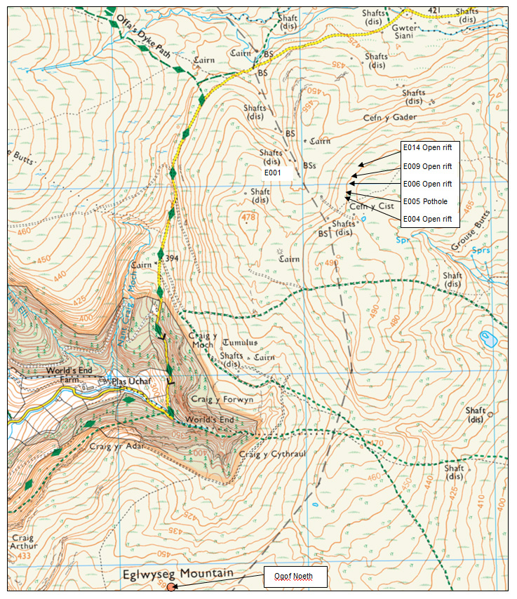
Martha's Pots, Esclusham Mountain Minera
CLICK IMAGE TO ENLARGE
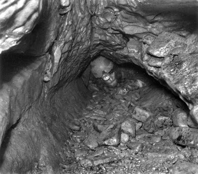
A line of shakeholes near Martha’s Shaft (a lead mine) about 1000m north of World’s End. All have small openings at their bases sitting over vertical rifts.
The largest (E005) descends about 10m to a clay floor in a chamber formed along the line of a fault. The fault quickly pinches out.
The floor deposits were examined many years ago for archaeological potential, with negative results.
Ladder and lifeline or SRT recommended.
E014 SJ2429649093 Open Rift
E009 SJ2426049043 Open Rift
E006 SJ2424249003 Open Rift
E005 SJ2422548947 Pothole
E004 SJ2421748928 Open Rift
The reference numbers relate to a rapid survey of open holes carried out in 2009/10. The full list of 26 locations can be seen on Page 15: Springs, Sinks & Shakeholes under Esclusham Mountain Shakeholes.
The area is best reached by parking at SJ237496 and walking south-east for about 800m. Strike off to the left just before reaching the mine waste tips.
--------------------------------------------------------------------------------------------------
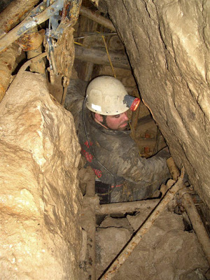
Millennium Pot SJ19046441 Depth 19m Alyn Gorge
A descending dig through clay and loosely-packed boulders creates a series of short laddered pitches: Entrance pitch 16ft: Pitch 2 14ft: Pitch 3 8ft: Pitch 4 8ft: Pitch 5 15ft.
Excavation follows the solid limestone wall downwards but requires enough people to haul the waste out to surface. No work appears to have been carried out for a few years (2022).
Access: On private land where an access agreement is in operation. Contact GCC or UCET for further information.
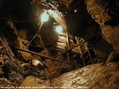
(see also Murphy’s Pot, in opposite side of same shakehole).
--------------------------------------------------------------------------------------------------
Matt's Cave SJ02357048 (Archwilio website) Cefn Archaeological
Silvester, R J & Owen, W J , 2002 , CPAT Report 467: Early Prehistoric Settlement in Mid and North-East Wales: the Lithic Evidence: http://www.walesher1974.org/herumd.php?group=CPAT&level=3&docid=301357517
--------------------------------------------------------------------------------------------------
Quarrying then took much of the cave away and it now only consists of a passage a few metres long to a bad collapse. The quarry is no longer in use.
Entering
Dyserth from the Trelawnyd direction, the north end of Moel Hiraddug
can be seen off to the left. The cave may still just be visible near to
top edge of the quarry.
NB
A cave was found in 1961 in Dyserth Quarry containing interesting formations close to Moel Hiraddug Cave. For details see 'Dyserth Quarry Cave' (Page 14. Lost & non-caves). It is possible the two caves were once connected and infers that a more detailed examination of the quarry could be worthwhile.
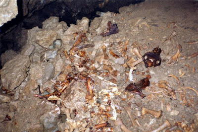
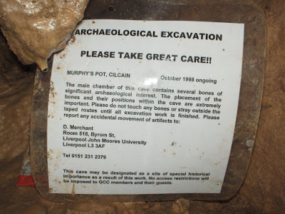
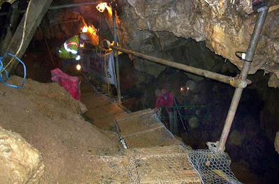
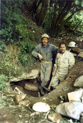
Murphy’s Pot
Depth 40m SJ1902964412 Alyn Gorge Archaeological (animal only)
Access: On private land where an access agreement is operating. Contact GCC or UCET for access information.
Warning: The cave is rather unstable and large areas of the boulder and clay floor are on the move.
Murphy's Pot entrance (not to be confused with Millenium Pot a few metres away)
Nant Gain Caves 1-10 SJ184650 Cilcain
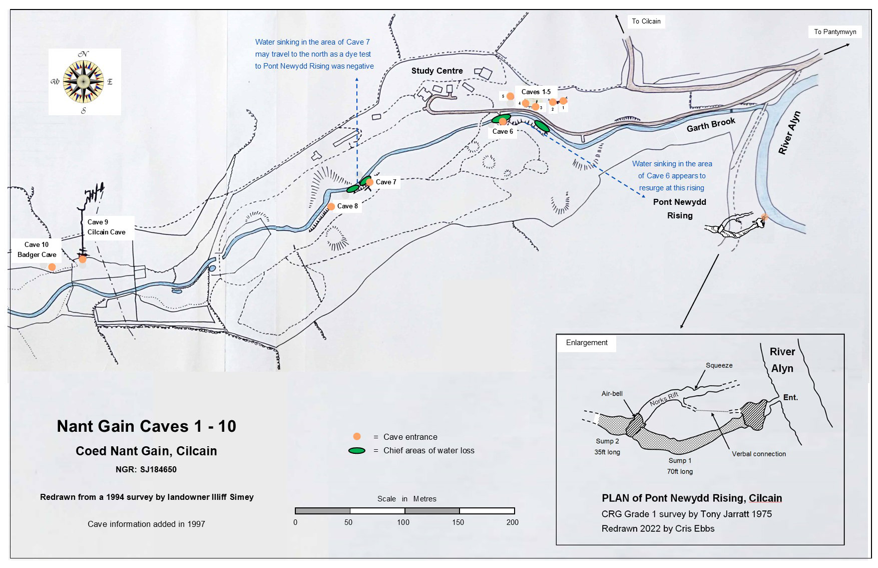
CLICK IMAGE TO ENLARGE
The valley contains 10 caves, although one or two others have been lost due to deliberate concealment of their entrances by a 'caver' over forty years ago.
NB Coed Nant Gain is a privately owned wood with a wildlife study centre. Prior permission to enter the land is required for all ten caves.
Cave 2: Length: 3m
Cave 3: Length: 10m
An undulating passage becoming blocked by clay.
The first of two caves in small outcrop immediately beside the track.
Cave 4: Length: 3m
Cave 5: Length: 4m?
A large entrance and short passage excavated by the landowner in the 1970s.
About 20 metres to the left of Cave 4 and about 20m above stream level.
Cave 6: Length: 3m
Cave 7: Length: 4m
A hands-and-knees passage excavated from the entrance in 1997 by GCC. Ends at a boulder and clay blockage.
Cave 8: Length: 8m
A low entrance opens immediately into a chamber with a 4m pot in the floor. At the bottom is a low bedding passage which was followed in 2011 (by UCET) to a point beneath the stream bed where daylight enters from above.
Entrance is about 3m above stream level in the south bank.
Cave 9:
Cilcain Cave
SJ1806264920 +/-12ft Length: 125m
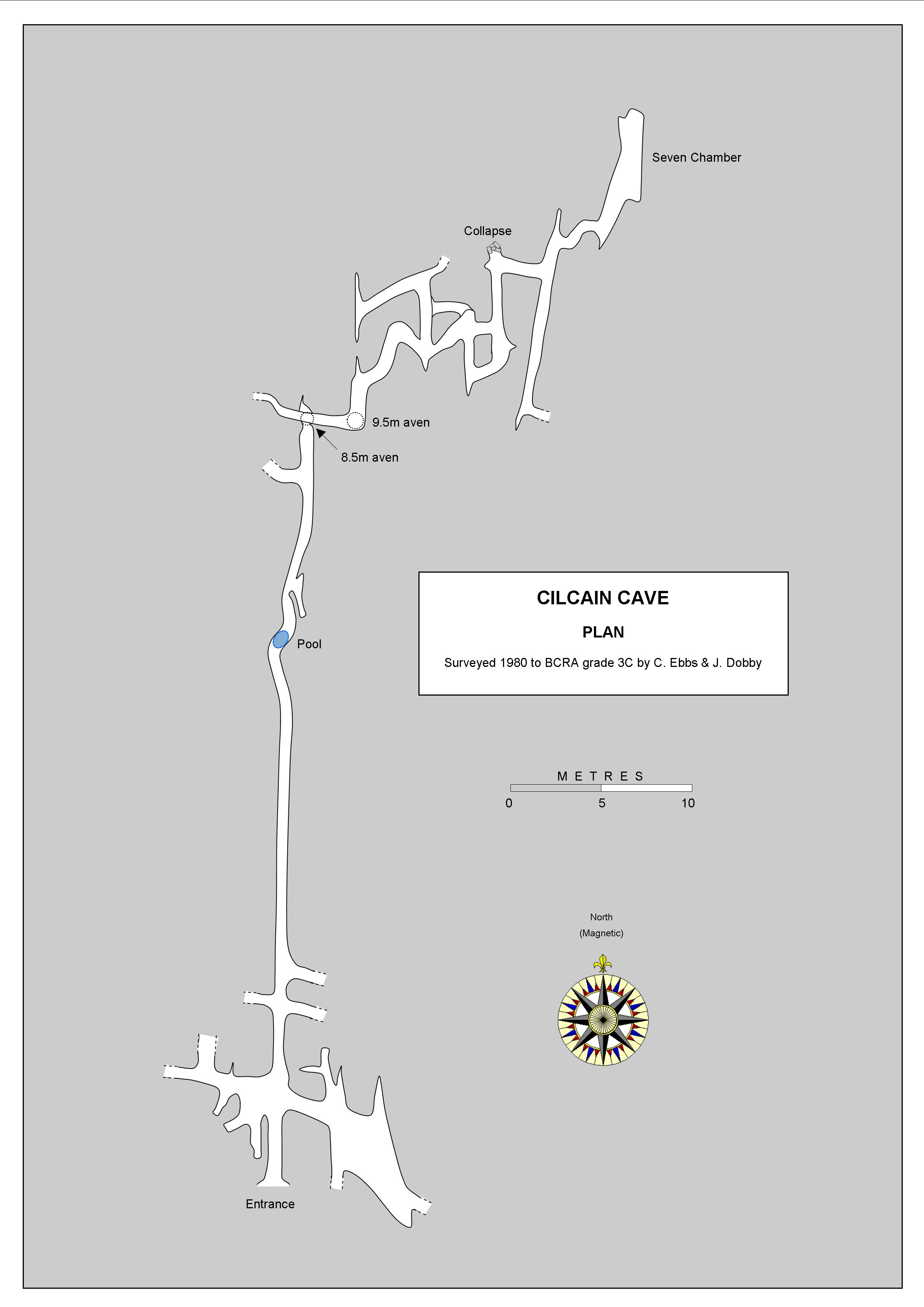
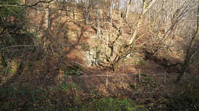
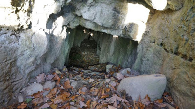
A small entrance opens into a narrow standing-sized rift chamber with low crawls off to left and right. The passage ahead was excavated between 1975 and 1979 by the writer & others. This extended the cave from 8 metres in length to about 120 metres. The resulting tight crawl with a wet pool, eventually leads to several narrow but roomy rift chambers up to 10m high. Good potential but the way on is not obvious. Further work at the end of the cave could be made far easier if the existing access passage was made larger by lowering the floor a few inches.
It was reported in 2013 that the passages just inside the entrance to the left and right, had been partially blocked by animal activity. The way on ahead may also need a little clearing to restore access.
Stride, A.H. & R.D. (1953), Britain Underground, by Dalesman Publishing and Jenkins, D.W and Mason-Williams, Ann. (1963 and 1967) "Caves in Wales and the Marches" , also by Dalesman Publishing.
Why CPAT chose to include this cave in a report on potential archaeological caves is a mystery, particularly when it only contains recent stream sediments (and badger detritus in the entrance area)...... whilst Caves 1 & 2 further downstream, which do appear to contain deposits of potential interest, were not mentioned.
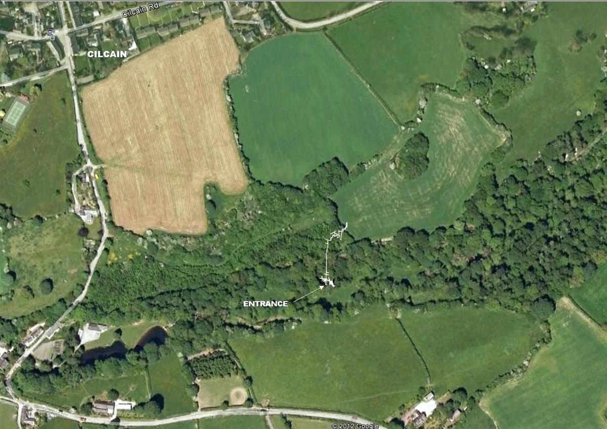
Nant Gain Cave No 9 (Cilcain Cave) plotted onto Google Earth image
Cave 10: Badger Cave Length: 40m
No artifacts were found during excavations. Fully excavated, the passage is no larger than 0.5m in height, hence the floor deposits are unlikely to be of archaeological interest.
About 30 metres upstream of Cave 9 (Cilcain Cave), just on the north side of a barbed wire fence.
Nant-yr-Ogof Length 6m SJ066806 Meliden
An uninspiring rock shelter with a silted tube leading off which becomes too low.